Here’s the updated weekend forecast, issued from the National Weather Service in Little Rock on Friday afternoon…
1. Very cold air is on its way to Arkansas this weekend. Much of the state will remain below freezing for two to six days straight starting New Year’s Eve.
2. Patchy Freezing Drizzle Friday night. Temps on Saturday will climb above freezing again. Light wintry mix Saturday night into Sunday morning. Any accumulations will be light, but anything that falls will stick because it’s so cold!
3. Wind chill values are expected to fall into the single digits to below 0°F across Arkansas Sunday Night into Monday morning. Dangerous wind chill temperatures are likely with impacts expected!
Details:
The cold air that arrives this weekend will likely be with us from this weekend through the end of next week! This is expected to lead to anywhere from 3 to 6 or more days of below freezing temperatures across the state of Arkansas. Northern Arkansas will likely see 6+ days where the temperature stays below freezing while central and south Arkansas are more likely to see 2-3 days of persistent sub-freezing temperatures. We had a period of very cold weather across Arkansas in early January of 2017, but that was quickly followed up by near record heat. We will be just as cold as we were in early January, but the heat is NOT coming this time around. It will stay cold as we head into early 2018, so prepare now for this extended period of cold weather!
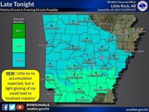
Widespread drizzle is expected to develop across Arkansas late tonight after midnight. Temperatures will start off above freezing, but will fall during the overnight hours. As temperatures fall below freezing late tonight, some of the drizzle may freeze into a very light glaze of ice, especially on elevated surfaces. Lows tonight are only expected to fall just below freezing with lows ranging from 28 to 32 degrees across northern and central Arkansas. Much of south Arkansas will remain above freezing and will not have to worry about freezing drizzle as a result. Any light ice accumulation is expected to melt on Saturday as temperatures climb above freezing for the last time in the next several days.
As the really cold air arrives Saturday night into Sunday…it may cause some light wintry precipitation to develop across the state. The mostly likely time period where we may see wintry precipitation is late Saturday night through Sunday morning. We are not expecting much wintry precipitation, but anything that falls is likely to stick because the ground temperatures are cold this time around. Precipitation may start out as a wintry mix Saturday evening/overnight before changing over to all light snow on Sunday. Any light ice/snow accumulations could lead to travel problems on New Year’s Eve (Sunday). We’re not expecting significant impacts, but it doesn’t take much frozen precipitation to cause problems.
Skies are expected to clear out and winds will become a bit breezy Sunday night into Monday morning. This will allow temperatures to fall into the single digits to upper teens across much of the state. The combination of winds will cause wind chill values to fall into the single digits to below 0°F across much of Arkansas Sunday night into Monday morning.
Anytime it’s expected to get this cold, there may be impacts across the state. Always remember to prepare a winter weather emergency supply kit in your car in case you get stranded. Inform friends and family about travel plans, and check idrivearkansas.com for the latest road conditions before heading out the door. Make sure you dress for the cold, and be extremely cautious when heating indoors. Fires and carbon monoxide can become deadly when improperly heating and venting those heat sources indoors.


