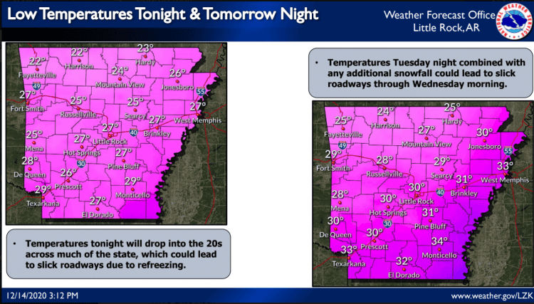
Another round of wintry precipitation will be possible Tuesday afternoon through Tuesday night. Snowfall totals are expected to be lower than what was seen over the weekend (around half an inch, with locally higher amounts possible), however some impacts are still possible. See daily forecast list after pink images below.
A storm system will bring rain and snow Tuesday afternoon through Tuesday Night. A rain/snow mix becoming all snow is most likely over portions of northern and central Arkansas, with mainly rain elsewhere. Light snow accumulation is expected over northern and central Arkansas, with higher amounts possible at the higher elevations. Much of the state will drop near or below freezing tonight and Tuesday night, which could make roadways slick. Therefore, some travel impacts are possible. Temperatures tonight and Tuesday night will drop near or below freezing statewide, and could lead to slick roadways and travel impacts.


