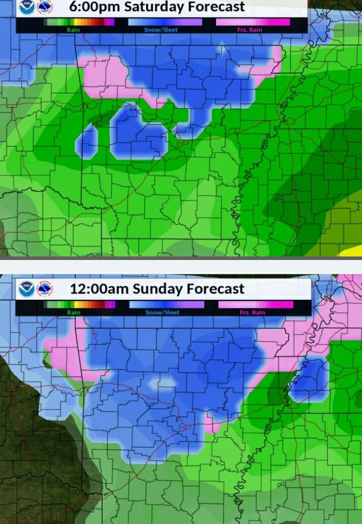
The following statement is an update by the National Weather Service in Little Rock on the winter weather forecast for this weekend.
Confidence continues to increase that a strong storm system will bring widespread precipitation to the state including winter weather to the north. Several inches of snow will be possible primarily across north central sections of the state. In addition, some freezing rain will be possible with a small part of the state possibly seeing as much as a quarter of an inch of ice.
The upper level part of the storm system is working its way through the desert southwest at this time and will continue to progress to the east through the weekend. A surface low pressure will develop along the Texas gulf coast Saturday morning pulling considerable amounts of moisture into the region. Some of that moisture will work into cold air that will moving in from the north resulting in a wintry mix across the north and possibly central sections of the state.
Rain is expected state wide initially on Friday before the colder air starts to arrive. The changeover to winter precipitation will begin across the north Friday night and into early Saturday. As the cold air moves south, the change over to winter precipitation will spread further south during the day Saturday. The system will move to the east early Sunday with the precipitation wrapping up early in the day.
The total amount of winter precipitation is dependent on when the coldest air arrives and when the deepest moisture departs so there is a bit of a race. There remains the potential of heavier amounts of winter precipitation if the cold air arrives earlier than expected or the storm system itself slows down.
Areas of the south could see in excess of 5 inches of rain from this system so it is not just winter weather to be concerned about. In the wake of the storm much colder air will settle over the state and water on area roads will likely freeze.
The forecast continues to evolve and some changes are to be expected over the next day or so.


