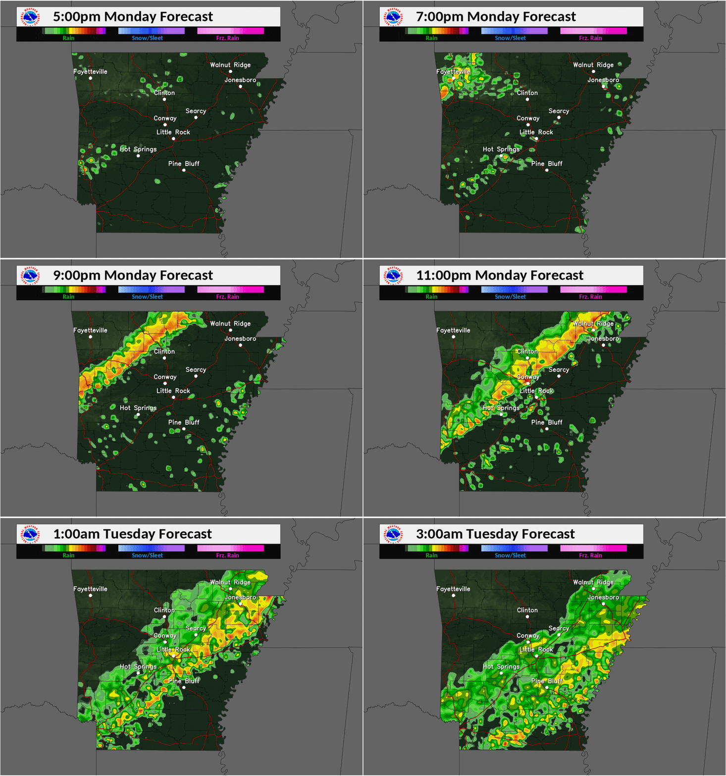
According to the National Weather Service (NWS), a line of thunderstorms is expected to accompany a cold front as it moves across the state Monday night and overnight. Strong to damaging wind gusts are mainly expected, but the NWS is not ruling out isolated tornadoes. There is a very low threat for flooding due to ongoing drought conditions. The threat for large hail is low as well.
The most likely time for storms across Arkansas is 5:00-8:00 p.m. in the northwest, 8:00 p.m. to midnight in central, and after midnight for the east and southeastern portions of the state. Storms in the northwest part of the state are most likely to produce severe weather.
Isolated to scattered showers and thunderstorms may persist behind the front, but the threat of severe storms behind the cold front is very low. Even though it’s December, severe storms are still possible here in Arkansas. Be prepared for the possibility of severe thunderstorm warnings this evening and overnight.
MySaline will update this forecast closer to time for the Saline County Christmas Parade.
MySaline will update this forecast closer to time for the Saline County Christmas Parade.


