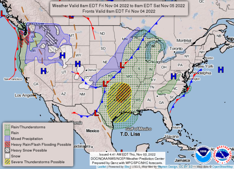
A storm system is headed toward Arkansas on Friday afternoon and is due to complete its progression across the state by early Saturday morning, according to the National Weather Service in Little Rock.
A north-south oriented cold front will approach Arkansas from the west with developing showers/thunderstorms reaching the Oklahoma/Arkansas border on Friday afternoon.
Storm mode will begin across far eastern Oklahoma and far western Arkansas as a line with the possibility of a few supercell thunderstorms ahead of the main line.
As storms enter the Natural State Friday afternoon/Friday evening and push eastward: the main threats will be severe damaging winds, isolated tornadoes that could spin-up within the line of storms, and heavy rainfall that could lead to localized flash flooding.
EXTENDED DAILY FORECAST:


