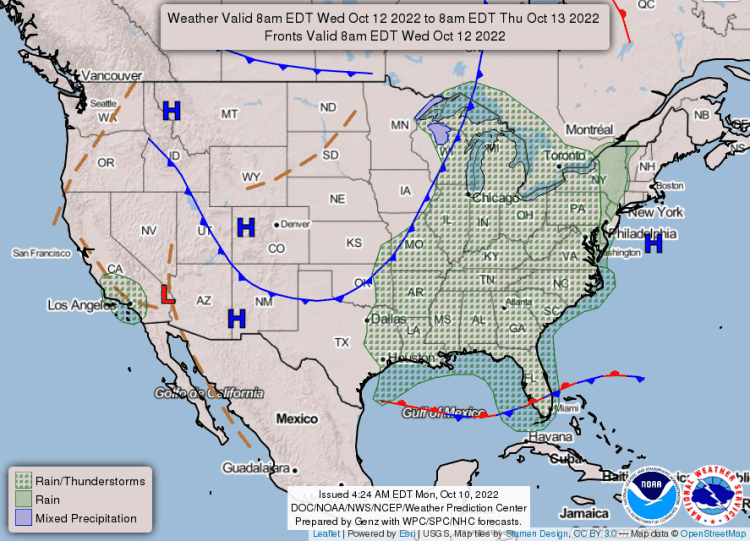
Expect ongoing drought and fire weather in the coming days. Wildfire danger will remain elevated through the middle of the week, but there are rain chances returning Wednesday into Thursday.
Overall rain amounts will likely remain below a half inch for most, so wildfire danger will continue. Isolated strong storms will also be possible on Wednesday.
This forecast is for the following areas:
Marion-Baxter-Fulton-Sharp-Randolph-Stone-Izard-Independence- Lawrence-Cleburne-Jackson-Conway-Faulkner-White-Woodruff-Perry- Garland-Saline-Pulaski-Lonoke-Prairie-Monroe-Pike-Clark- Hot Spring-Grant-Jefferson-Arkansas-Dallas-Cleveland-Lincoln- Desha-Ouachita-Calhoun-Bradley-Drew-Boone County Except Southwest- Newton County Higher Elevations-Searcy County Lower Elevations- Southern Johnson County-Southern Pope County- Southeast Van Buren County-Western and Northern Logan County- Northern Scott County-Northwest Yell County- Polk County Lower Elevations- Central and Eastern Montgomery County- Boone County Higher Elevations-Newton County Lower Elevations- Northwest Searcy County Higher Elevations- Johnson County Higher Elevations-Pope County Higher Elevations- Van Buren County Higher Elevations- Southern and Eastern Logan County- Central and Southern Scott County-Yell Excluding Northwest- Northern Polk County Higher Elevations- Northern Montgomery County Higher Elevations- Eastern, Central, and Southern Searcy County Higher Elevations- Southeast Polk County Higher Elevations- Southwest Montgomery County Higher Elevations.
DAILY FORECAST:


