Scroll down to see the 7-Day Forecast
Arkansas is continuing draught conditions until midweek, when rain and winds from tropical activity are expected, according to the National Weather Service in Little Rock. Here’s the forecast:
Dry air will be in place Monday. Afternoon RH values are expected to fall to near 20% in many areas. This could lead to an increase in wildfire danger across the state during the afternoon hours.
Showers and thunderstorms will return to the forecast beginning Wednesday through early Friday morning as a potential tropical system affects the state.
Some locally heavy rain and gusty winds will be possible across mainly eastern locations. The chances for organized severe weather is low at this time, however, a few strong thunderstorms will be possible Wednesday through Thursday evening.
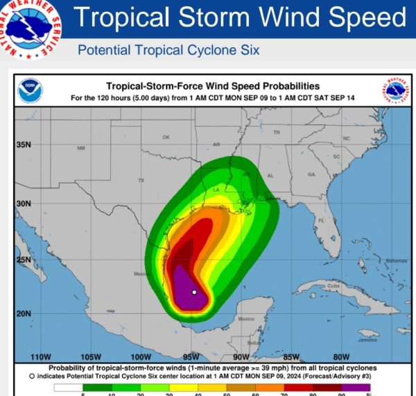
Potential Tropical Cyclone (PTC) Six formed late Sunday and is expected to make landfall on the Texas/Louisiana coast Wednesday night. The system is then expected to track towards Arkansas as it begins to weaken.

Tropical storm force winds are not expected across the state at this time, but heavy rainfall and isolated tornadoes or damaging wind gusts are possible.
The heaviest rainfall is expected across the eastern half of the state where 2-4 inches will be possible. Rainfall totals will be dependent on the track of the system. A track farther to the east will mean less rain for the state.
7-DAY FORECAST


