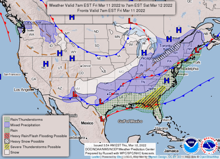
A strong cold front will surge through Arkansas on Friday. The front will be followed by much colder air.
Accumulating snow is expected across much of the higher terrain of the Ozark and Ouachita Mountains (northern and western sections of the state) Friday morning through the afternoon. Snow is expected to shift into areas farther south and east by later in the afternoon into the evening hours.
The forecast calls for snowfall from two to four inches in parts of the Ozark and Ouachita Mountains, and some one to two inch totals from central into northeast Arkansas. Elsewhere, a dusting up to an inch of accumulation is expected.
See the extended 7-day forecast below ?
Winter Weather Advisories are in effect from early Friday morning through early Saturday morning for much of the state. Snow could impact roadways as it accumulates, but it will initially take some time to overcome warm ground conditions. For many, the snow that accumulates may be limited to grassy areas and elevated surfaces.
By Saturday morning, precipitation will be out of the state but you can still expect temperatures well below average – in the teens and 20s. Minimum wind chill index are expected in the single digits and teens.
EXTENDED FORECAST:


