Scroll down for the 7-day forecast! ?️
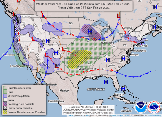
Dense fog will persist through much of the morning over a large part of Arkansas with improving visibility on Sunday afternoon. By late this evening into tonight, showers and storms will develop as a cold front moves into the state, according to the National Weather Service in Little Rock.
Some severe weather will be possible in northwestern Arkansas with damaging winds the most likely threat. Additionally, strong non-thunderstorm winds are forecast this evening through early Monday afternoon with maximum gusts approaching 50 mph possible.
Strong southwest winds will develop Sunday night and Monday morning across much of the state. Gusts could reach 40 to 50 mph, and could bring down trees/tree limbs in places and cause spotty power outages.
Another round of rain along with thunder will be noted Wednesday and Thursday. Rain could be heavy in places, with one to two inches expected and locally higher totals. This could result in localized flash flooding.
Before precipitation ends early Friday, colder air will build into the area from the northwest. Rain may change to light snow in the Ozark Mountains.
7-DAY FORECAST:


