THE NATIONAL WEATHER SERVICE HAS ISSUED A TORNADO WATCH IN EFFECT UNTIL 4AM TUESDAY FOR THE FOLLOWING COUNTIES:
IN CENTRAL ARKANSAS
CONWAY FAULKNER GARLAND PERRY POPE PULASKI SALINE YELL
IN NORTH CENTRAL ARKANSAS
BAXTER BOONE CLEBURNE FULTON IZARD MARION NEWTON SEARCY STONE VAN BUREN
IN SOUTHWEST ARKANSAS
PIKE
IN WESTERN ARKANSAS
JOHNSON LOGAN MONTGOMERY POLK SCOTT
THIS INCLUDES THE CITIES OF BENTON, BOONEVILLE, BRYANT, BULL SHOALS, CALICO ROCK, CHEROKEE VILLAGE, CLARKSVILLE, CLINTON, CONWAY, DANVILLE, DARDANELLE, FAIRFIELD BAY, FLIPPIN, GLENWOOD, HARRISON, HEBER SPRINGS, HORSESHOE BEND, HOT SPRINGS, JASPER, LESLIE, LITTLE ROCK, MAMMOTH SPRING, MARSHALL, MELBOURNE, MENA, MORRILTON, MOUNT IDA, MOUNTAIN HOME, MOUNTAIN VIEW, MURFREESBORO, NORMAN, NORTH LITTLE ROCK, OLA, OXFORD, PARIS, PERRYVILLE, RUSSELLVILLE, SUMMIT, WALDRON, WESTERN GROVE, AND YELLVILLE.
See the full forecast below ?
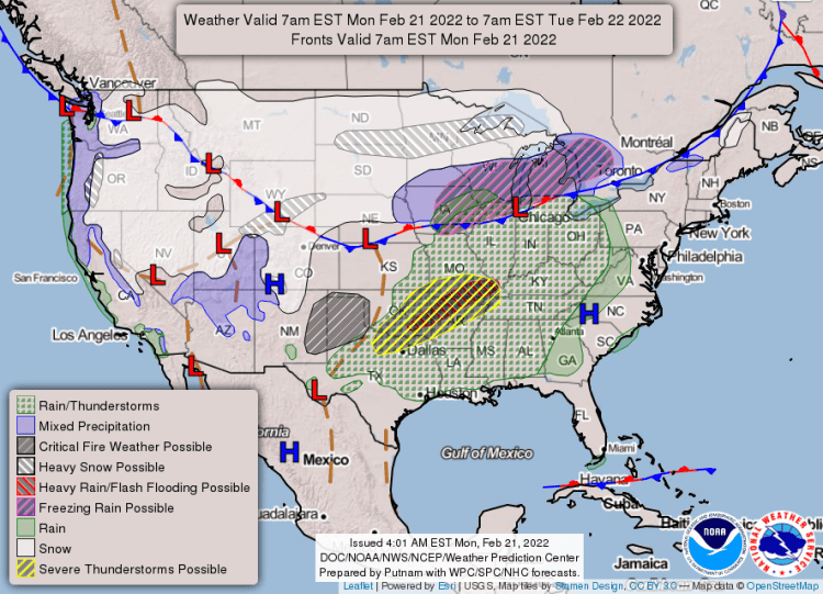
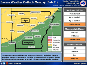
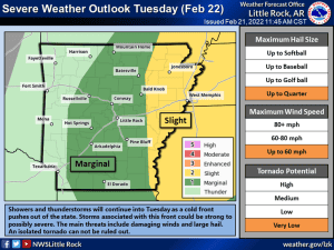
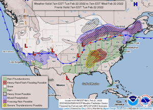
Several rounds of showers and thunderstorms are expected to impact the state today through Friday morning. The best chance for severe weather looks to be today through Tuesday afternoon as the first system pushes through the state. The greatest threats include large hail and damaging winds, although an isolated tornado cannot be ruled out.
- Monday
- Tuesday
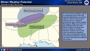
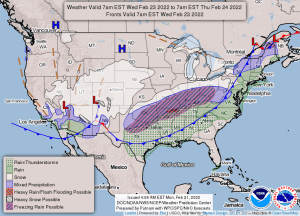
Additionally, there appears to be a chance for winter weather Wednesday through Friday morning as temperatures drop behind the cold front and additional systems move in behind it. Right now, the best chance for wintry precipitation appears to be northern Arkansas as that is where the coldest air will be located.
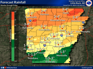
- Rain forecast
- Winter returns?
Lastly, models continue to show rainfall totals, through Friday, as a widespread two to four inches across the state with lesser amounts further south. Locally higher amounts are possible, especially for northern areas. The threat for flash flooding remains isolated at this moment. Expect to see rises on rivers due to runoff this week.
- Tuesday
- Wednesday
EXTENDED FORECAST:


