Click here for ? winter weather closings.
Make sure you’re looking at the newest forecast by going to www.mysaline.com/events/weather/
UPDATE 7:30PM MON JAN 30:
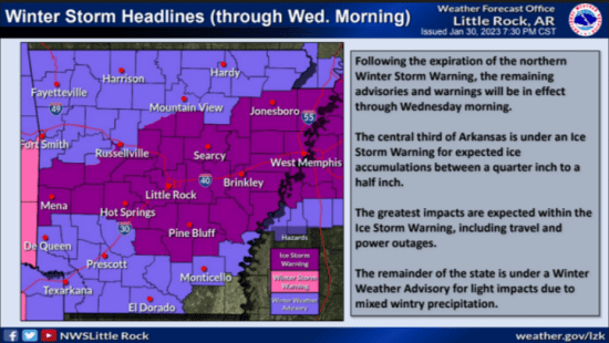
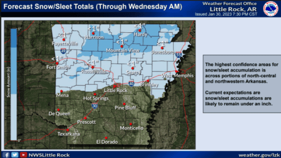
The National Weather Service in Little Rock has updated the winter forecast as of 7:30 p.m. Monday. Temperatures across the northern half of the state this evening are at or below freezing, with wintry mixed precipitation ongoing up to the Little Rock metro area.
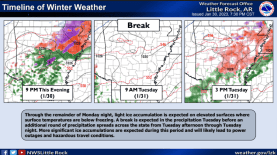
Freezing rain and sleet is expected to continue through tonight; however, overall travel impacts and accumulations are expected to remain minimal, with bridges and overpasses likely becoming hazardous and icy by Tuesday morning from any accumulations that do occur.
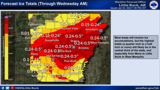
A brief break is expected early Tuesday morning, and another system (the main freezing rain producer) is expected to move in Tuesday afternoon, affecting a larger portion of the state. Total ice accumulation through Wednesday morning is expected to be less than a quarter inch in most locations, but up to a half inch (significant) across portions of central, east-central, and northeastern Arkansas.
Scroll down for the 7-Day-Forecast.
Don’t forget the 4 Ps – Here’s what you need to do when it’s freezing weather: www.mysaline.com/4p/
Scroll down for the 7-Day-Forecast.
?Expect power outages and tree damage possibly happening due to the ice. Keep your phone charged so you can make a call. ? Travel could be nearly impossible in places. If you have to go out on slick roads, bring extra clothes, a blanket, sensible shoes, snacks and water just in case you get stranded.
Don’t forget the 4 Ps – Here’s what you need to do when it’s freezing weather: www.mysaline.com/4p/
7-DAY FORECAST:


