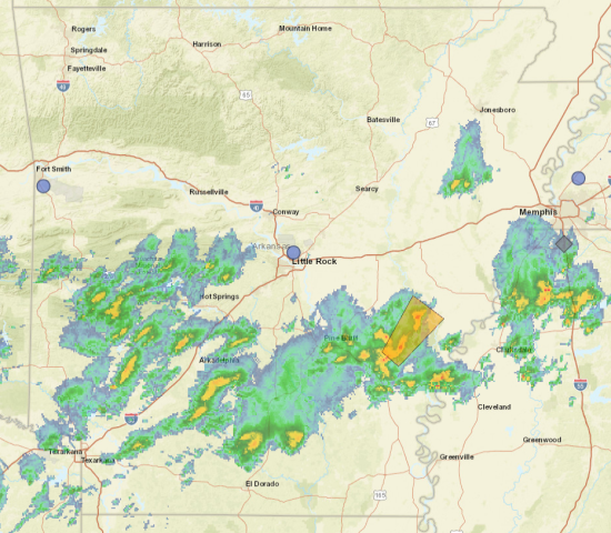
The National Weather Service in Little Rock has issued a Flash flood warning January 2 at 9:55pm until January 3 at 12:55am.
Southeastern Garland County in central arkansas…
Northwestern grant county in central arkansas…
Central pulaski county in central arkansas…
Saline county in central arkansas…
Clark county in southwestern arkansas…
Hot spring county in southwestern arkansas…
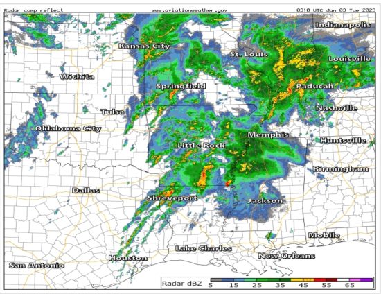
At 955 pm cst, doppler radar indicated thunderstorms producing heavy rain across the warned area. Between 1 and 2 inches of rain have fallen. Additional rainfall amounts of 1 to 2 inches are possible in the warned area. Flash flooding is ongoing or expected to begin shortly. Hazard…flash flooding caused by thunderstorms.
Impact…flash flooding of small creeks and streams, urban areas, highways, streets and underpasses as well as other poor drainage and low-lying areas.
Some locations that will experience flash flooding include… Little Rock, North Little Rock, Hot Springs, Benton, Sherwood, West Little Rock, Maumelle, Bryant, Hot Springs Village, Arkadelphia, Malvern, Downtown Little Rock, Southwest Little Rock, Haskell, Shannon Hills, Gurdon, Argenta, Rockport, Caddo Valley and Traskwood.
Update Jan 2, 130pm – TORNADO WATCH (Scroll Down for Full Forecast)
The National Weather Service in Little Rock issued a Tornado Watch on January 2 At 1:22pm to last until January 2 At 9:00pm
This watch includes the following 36 counties
- In Central Arkansas – Conway Faulkner Garland Grant Lonoke Perry Pope Prairie Pulaski Saline White Yell
- In Eastern Arkansas – Jackson Lawrence Woodruff
- In North Central Arkansas – Cleburne Independence Izard Newton Searcy Sharp Stone Van Buren
- In Southeast Arkansas – Cleveland Jefferson
- In Southwest Arkansas – Calhoun Clark Dallas Hot Spring Ouachita Pike
- In Western Arkansas – Johnson Logan Montgomery Polk Scott
This Includes The Cities Of Arkadelphia, Ash Flat, Augusta, Batesville, Beebe, Benton, Booneville, Bryant, Cabot, Calico Rock, Camden, Cave City, Clarksville, Clinton, Conway, Cotton Plant, Danville, Dardanelle, De Valls Bluff, Des Arc, Fairfield Bay, Fordyce, Glenwood, Hampton, Hardy, Hazen, Heber Springs, Horseshoe Bend, Hot Springs, Hoxie, Jasper, Kingsland, Leslie, Little Rock, Lonoke, Malvern, Marshall, Mccrory, Melbourne, Mena, Morrilton, Mount Ida, Mountain View, Murfreesboro, Newport, Norman, North Little Rock, Ola, Oxford, Paris, Perryville, Pine Bluff, Rison, Russellville, Searcy, Sheridan, Thornton, Waldron, Walnut Ridge, and Western Grove.
Update Jan 2, 8am – FLOOD WATCH (Scroll Down for Full Forecast)
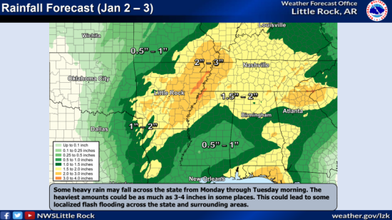
The National Weather Service in Little Rock has issued a Flood Watch for Monday, January 2nd at 2:33 a.m. until Tuesday, January 3rd at 6:00 a.m. Flooding caused by excessive rainfall is possible.
This watch is for portions of central Arkansas, eastern Arkansas, southeast Arkansas and southwest Arkansas, including the following counties: Central – Faulkner, Garland, Grant, Lonoke, Prairie, Pulaski, Saline and White. Eastern – Jackson, Monroe and Woodruff. Southeast – Arkansas, Bradley, Cleveland, Desha, Drew, Jefferson and Lincoln. Southwest – Calhoun, Clark, Dallas, Hot Spring, Ouachita and Pike.
Excessive runoff may result in the flooding of rivers, creeks, streams, and other low-lying and flood-prone locations. Widespread rain and thunderstorms are expected to develop and move across the watch area. Expect 2-3 inches of rain, along with some higher amounts, which could lead to flash flooding.
FULL FORECAST:
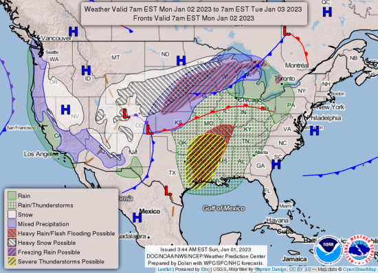
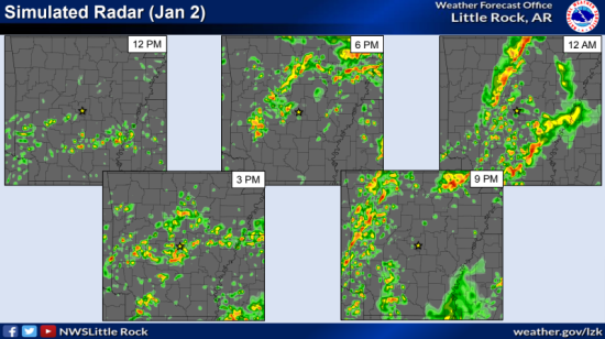
Another storm system will move across the region Monday and Monday night, according to the National Weather Service in Little Rock. This will bring widespread showers, along with strong to severe thunderstorms.
All modes of severe weather will be possible. Additional hazards include potential for heavy rainfall, which may lead to localized flooding.
Here’s the breakdown:
Thunderstorms are expected to develop Monday through Monday night. Some of these could become severe. Parts of Arkansas will have the potential to see all types of severe weather Monday. Heavy rain with localized flash flooding may also be a concern across parts of the state.
Rain and thunderstorms may be ongoing through the day. This is not expected to diminish the severe weather threat entirely, but could limit instability in some locations.
There is some potential for a few strong tornadoes (EF2 or greater) in the Enhanced Risk area.
EXTENDED DAILY FORECAST:


